
Adventure Ruck 2026 — Route
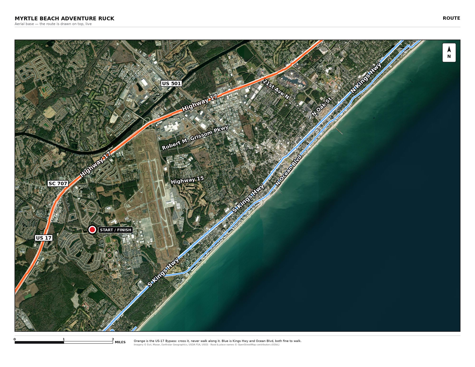
Printed version is the plan as it was before you started changing it.
#1 · Hybrid House
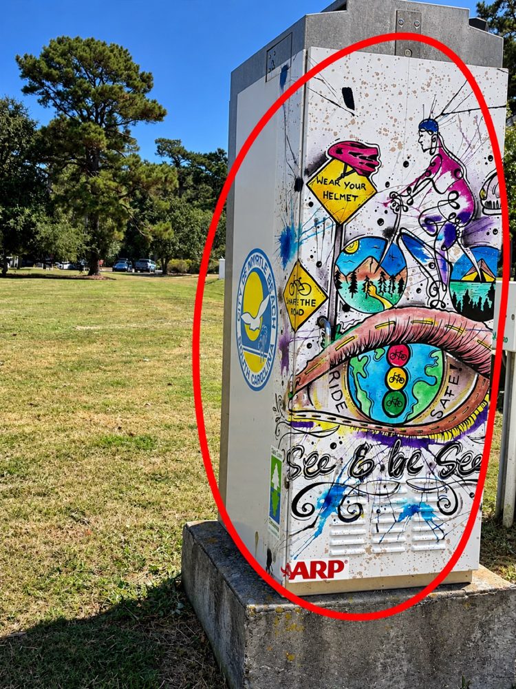
#22 · Eye on Harrelson (painted signal box, Harrelson Blvd at Jetport Rd NE corner - FOUND 09:35, 3 pts)
 tap to enlarge
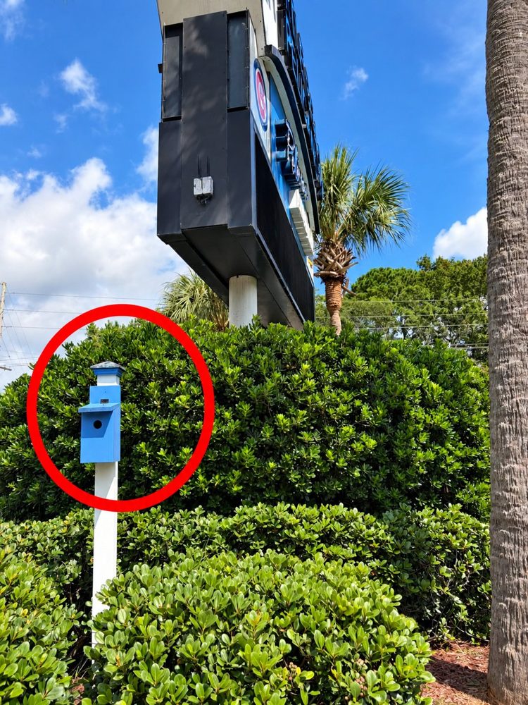
#18 · Feathered Dugout (birdhouse under the Pelicans Ballpark sign, 2 pts)
 tap to enlarge
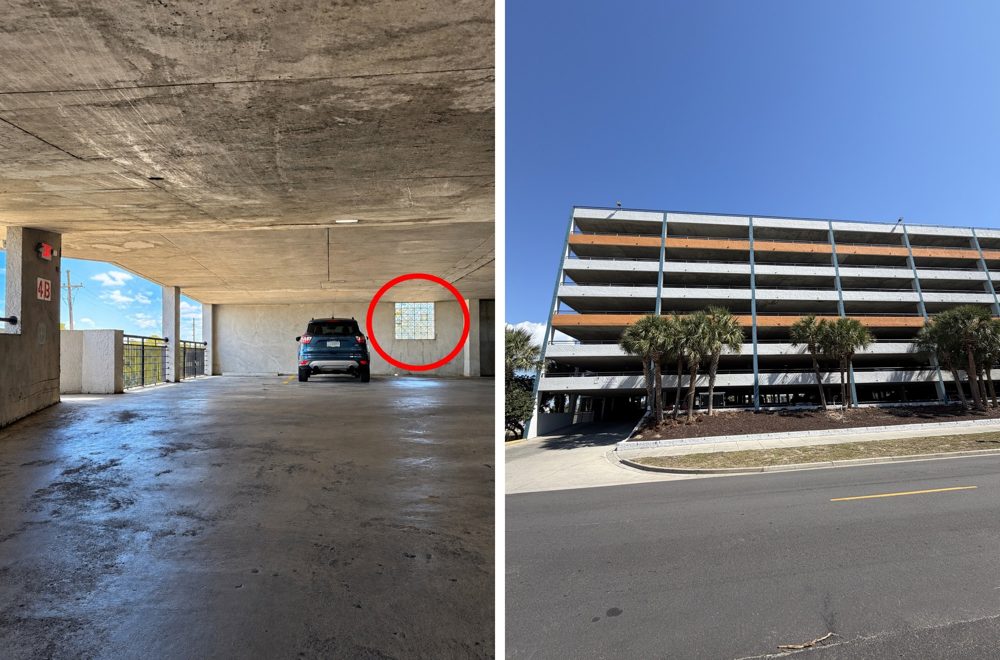
#21 · Yaupon Garage (Sea Mist parking deck, Yaupon Dr at 13th Ave S, level 4B glass block, 3 pts)
 tap to enlarge
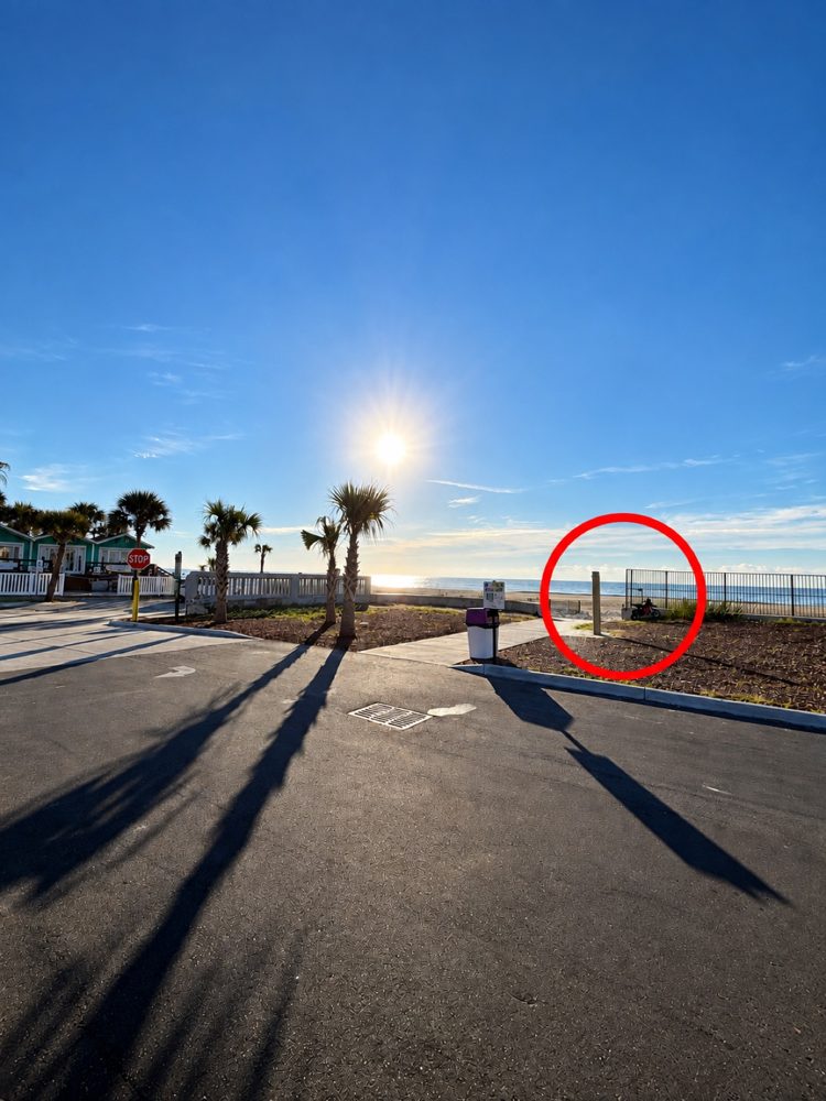
#20 · Get Clean (beach rinse post by the teal cottages - candidate, 2 pts)
 tap to enlarge
#11 · Warbird
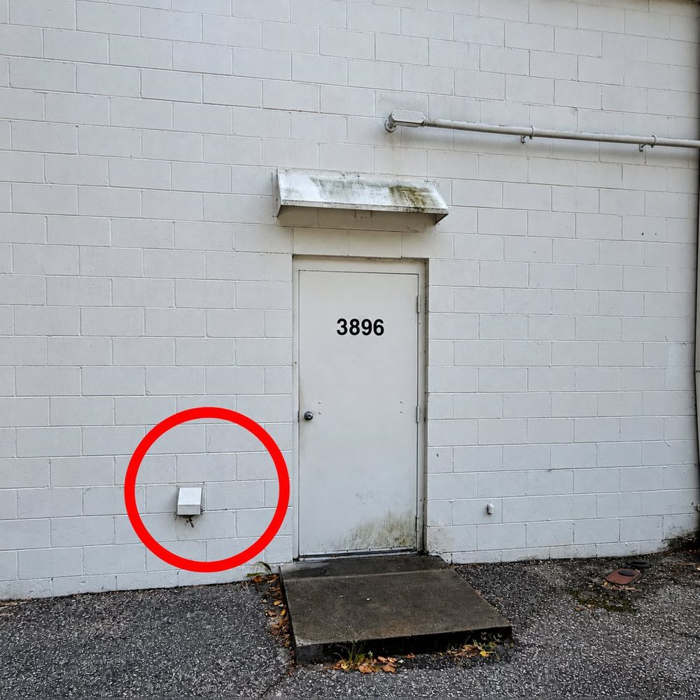
#16 · 3896 (door by the Harley-Davidson dealer, 2 pts)
 tap to enlarge
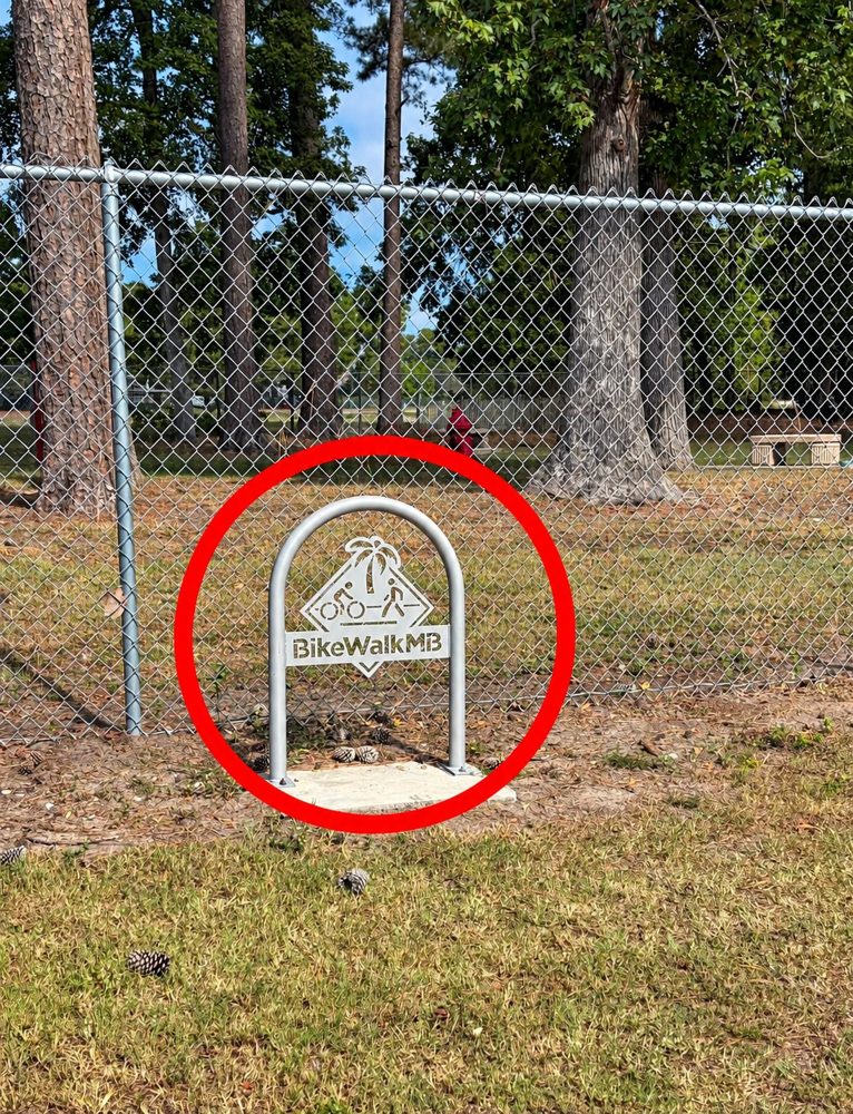
#19 · B W MB (BikeWalkMB rack - New Town Bark Park, 200 Collins St at Broadway - likely, 2 pts)
 tap to enlarge
Not on the route — and why
Cheapest way each one could be squeezed back in, against the time we actually have. Nearest misses first.
- #3 HBSneeds 64 more min (2.9 mi detour); only 46 min spare
- #2 Treasureneeds 82 more min (3.8 mi detour); only 46 min spare
What each button does ▾
- Start now — press it as you cross the start line. Stamps the real clock as the start and times the whole day from it. No typing.
- Use typed — applies the time in the box instead, for correcting the start afterwards. Re-times every stop, including ones already ticked.
- Recalculate times from now — rebuilds the ETAs for what is LEFT, from the real Eastern clock, carrying on from your last completed stop. Stops already done keep the times they happened at.
- Publish to the team — the ONLY thing that sends anything to Brian and Scott. Everything you do before pressing it is yours alone: skip three stops, look at the finish time, put them back, and nobody else ever knew. The team PIN is typed once on this phone, not once per publish. The line under the buttons tells you how many changes are waiting, in red, so you cannot think you published when you did not. Reading is still automatic — the page keeps pulling their version every 15 seconds, so you never go blind to what they are doing while you are gaming something out.
- Use / Fix and re-plan — on a red card, one the geocoders could not agree about. USE says "this pin is the place"; FIX says "this address is" — or, pasted from Google Maps, "these coordinates are". Either goes to the team and to defiance in one push, defiance re-plans the whole route and publishes a new page in about four minutes, and a bar appears at the bottom of this one offering to load it. Navigate points at the corrected place at once.
- Team PIN — typed once on each phone (SETUP tab), kept there. Reading and following the plan never needs it; sending anything does. A gold bar at the top says so until it is typed, and the line under the PIN box says whether this phone has it.
- Edit → Re-plan the route here — the same thing on ANY card. Google put the pin dead centre of the state park; the entrance is half a mile away. Long-press the entrance in Google Maps, copy the coordinates, paste them in the Edit box, tap this. "Use for Navigate" above it is the quiet version: this phone's Navigate only, nothing sent, no re-plan.
- Undo — steps back through your last 30 changes on this phone, one at a time. Undo everything unpublished and you are level with the team again.
- Discard my changes — drops the whole experiment at once and goes back to the team's published version. Undo is the step-by-step version of this.
- Re-plan the rest from here — re-orders only the stops still to do, starting from the last one you ticked. Completed stops are left alone. You rarely need it — skipping and adding re-plan themselves. Press it after ticking stops done, after fixing an address, or to force the question again.
- Start over — everyone — puts all three phones back to the printed plan. This one publishes itself, on purpose: reaching Brian and Scott is the entire point of it.
- Skip / Add to route — take a stop off, or put one on. The order of everything still ahead is re-planned on the spot, and the miles, ETAs and map redraw for that order — no second button. It never quietly makes the route longer. It will happily hand you one that misses a cutoff or gets back late — sometimes that is the right trade — but it says so in a warning you have to tap away. Nothing is ever refused, and nothing leaves this phone until you Publish.
- Mark done — freezes that stop. Re-planning and “recalculate from now” both leave it where it is. Like everything else, it reaches the other two when you Publish — so publish your ticks, they are the one thing the team genuinely needs.
- min at this stop — how long we stand there taking the photo or doing the challenge, not the walk to get to it. Tap the number to say how long it really took; 6 and 18 minutes are guesses and a timed gym challenge blows straight through them.
Paper backup & downloads atlas · itinerary · route map
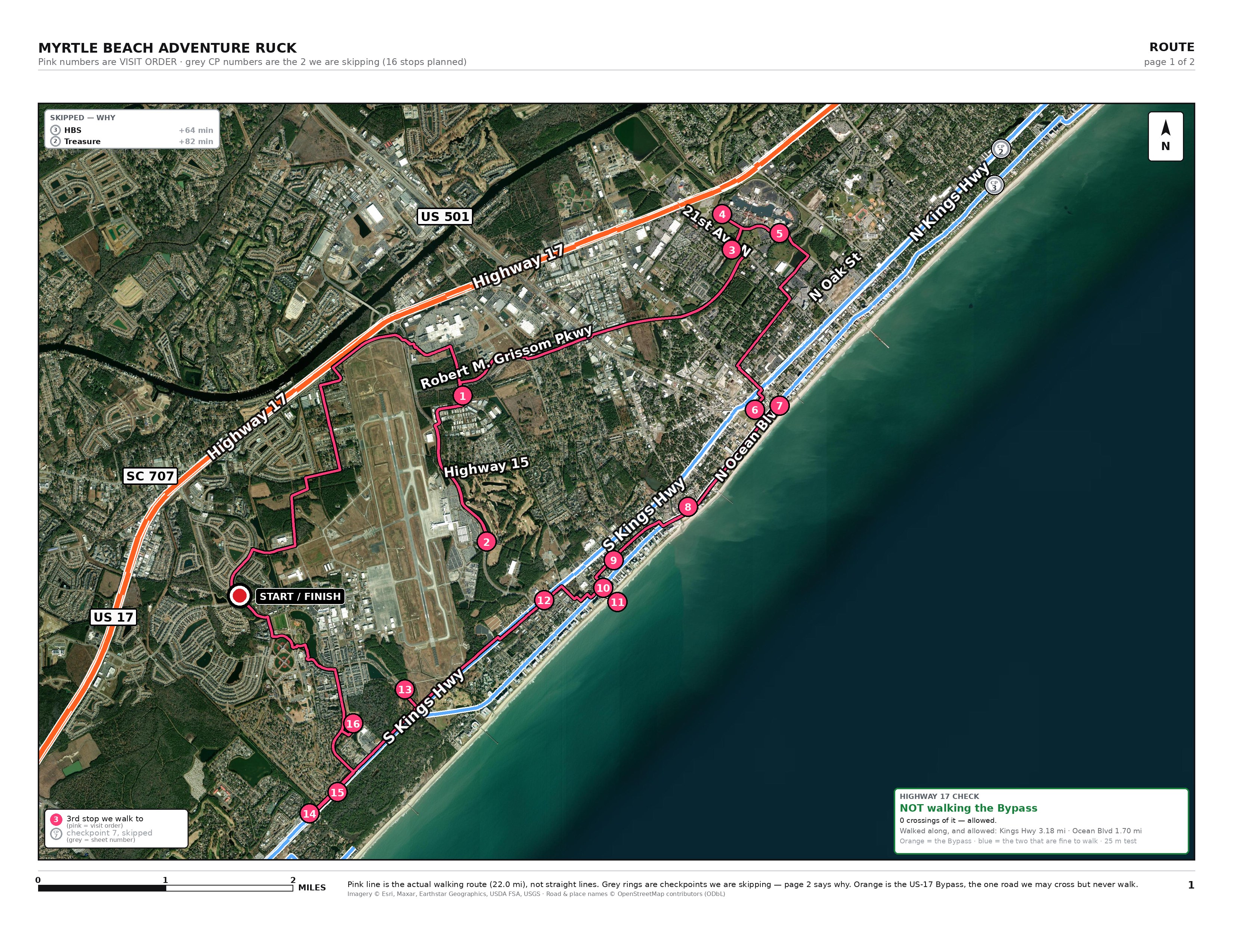
Navigate opens Google Maps and walks you from wherever you are standing to that stop. Mark done, Skip and Add to route stay on this phone until you press Publish to the team in SETUP, so you can try a route and look at it before anyone else sees it; the line under those buttons counts what is waiting. Their version keeps arriving here every fifteen seconds either way. Tap any stop’s min here figure to say how long it really took; eight minutes is only a guess and the timed challenges blow straight through it.
Kit: materials are provided at checkpoints (Wyatt, from 2025)
Distances are walking miles (OpenRouteService). ETAs assume 3.0 mph moving and 6 min per stop (18 at mandatory ones) from a 07:00 start — they drift as the day goes on; trust the clock, not the ETA. Generated 2026-10-03.